Fact-checked 22 July 2026.
Eastern Sicily is three overlapping landscapes, not one destination
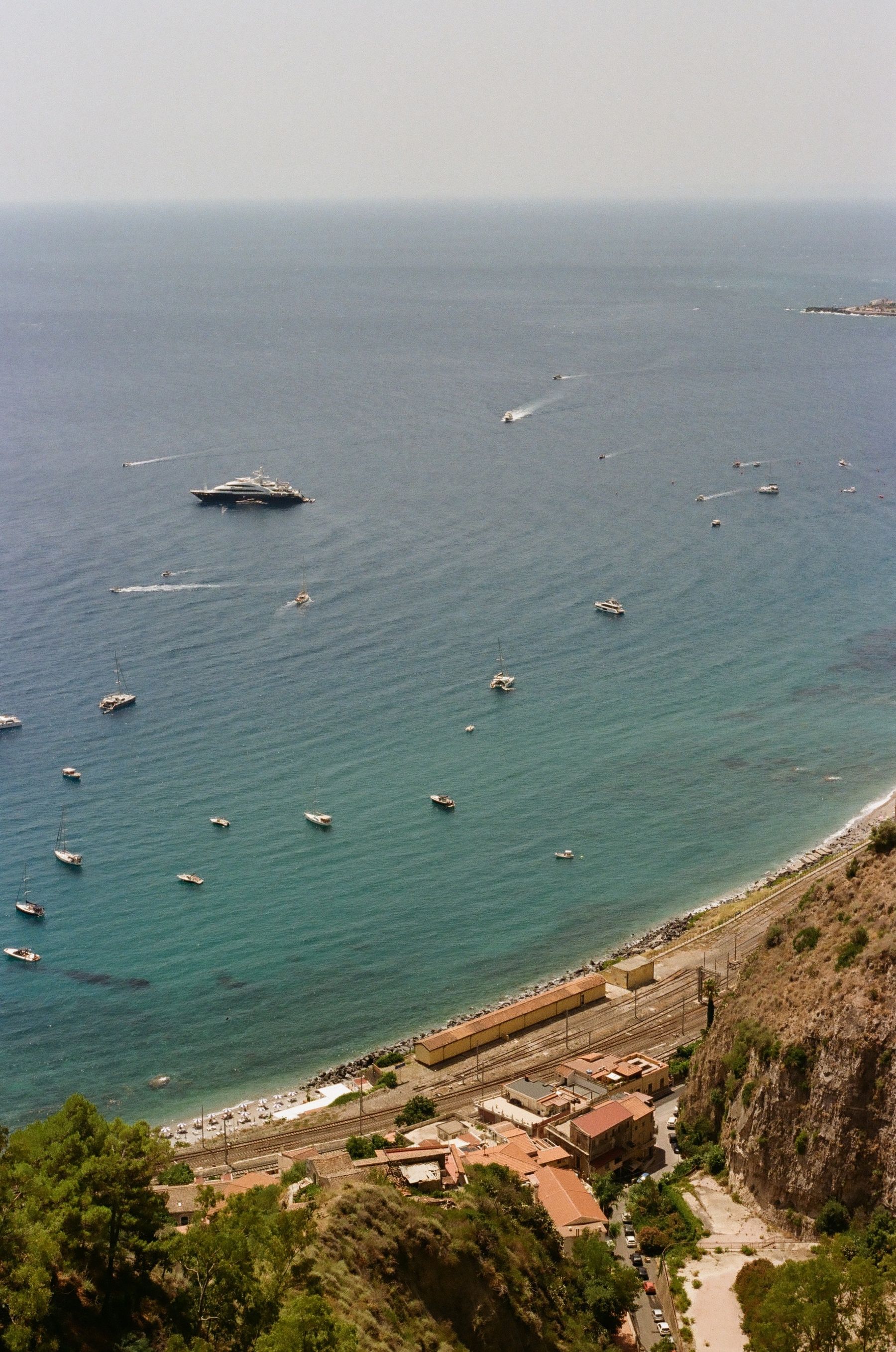
A list of things to do in eastern Sicily becomes misleading when it treats the region as a collection of pins that can be visited in any order. The Ionian coast between Messina and Syracuse, the inhabited slopes of Etna and the Baroque south-east are historically connected but work differently on the ground. Along the sea, bays, railway stations and the A18 motorway organise movement. On Etna, altitude, wind and volcanic conditions determine access. South of Catania, the terrain opens, the stone becomes paler and the distances between Baroque towns feel longer than they appear on a screen.
A successful trip is therefore less about collecting all twenty places than choosing a coherent portion of the island. From a base in Giarre, Taormina, Giardini Naxos, Alcantara, Catania, the Aci coast and several Etna towns are credible day trips. Syracuse and Noto make longer days; Ragusa and Modica are better with a south-eastern overnight stay or a second base. Our seven-day Sicily road trip shows how to preserve time for the places themselves rather than spending every afternoon relocating and parking.
History explains why the places are where they are
The east coast was one of the principal gateways into ancient Sicily. Greek settlers from Euboea founded Naxos in the eighth century BCE, and connections from there helped establish settlements including Katane, modern Catania. Syracuse became one of the most powerful Greek cities in the Mediterranean, while indigenous Sicel communities continued inland. Roman rule reused ports, roads and agricultural territories. Byzantine, Arab, Norman, Swabian and Spanish institutions subsequently occupied and altered the same strategic geography.
Two natural disasters are essential to the urban landscape visible today. Etna's 1669 eruption sent lava into the western and southern edges of Catania and changed the coast around Castello Ursino. The 1693 earthquake destroyed much of south-eastern Sicily. Reconstruction did not produce a single Baroque stage set. Catania was rebuilt on its existing site, Noto moved, and Ragusa developed both an older and a newer centre. UNESCO presents the eight Late Baroque Towns as one collective yet varied rebuilding achievement. That context helps explain the black lava detailing of Catania beside the warm limestone of Noto and Syracuse.
Twenty sights arranged by geography
1. Piazza del Duomo and La Pescheria, Catania
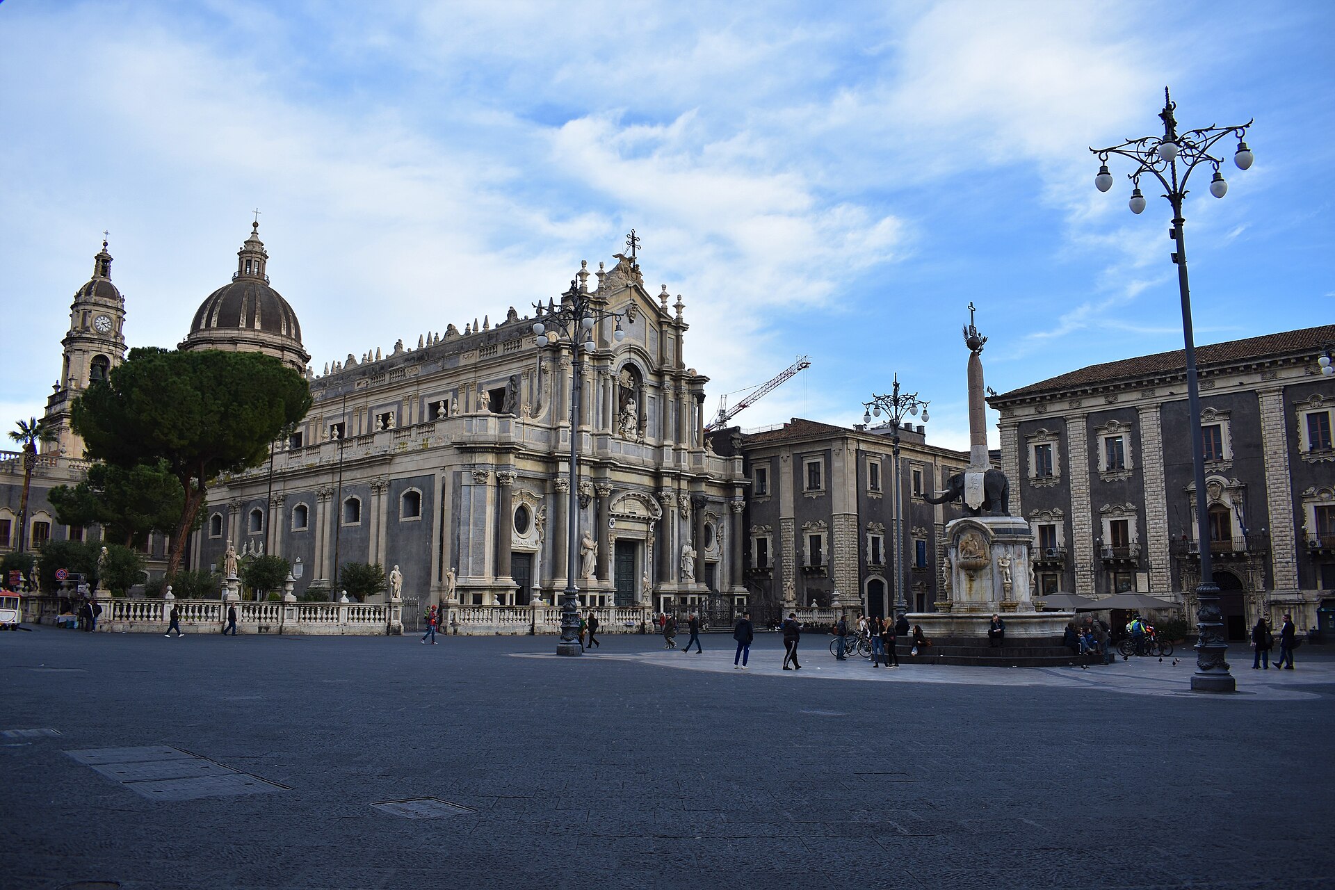
Piazza del Duomo is the clearest place to begin reading Catania. The Elephant Fountain, Cathedral of Sant'Agata, city hall and the start of Via Etnea bring religious, political and commercial histories into one space. Walk behind the Fontana dell'Amenano to the fish market in the morning. La Pescheria is a working food market, not staged theatre, so leave room for porters, traders and customers. The square is only the beginning of a proper city day; use our Catania things-to-do guide for a complete walking route.
2. Via Crociferi and the Benedictine monastery
Via Crociferi expresses the ecclesiastical power of the reconstruction after 1693. The Monastero dei Benedettini at Piazza Dante reveals its scale and contradictions. Founded in 1558, the complex was damaged by lava and earthquake, rebuilt from 1702 and eventually incorporated into the university. A guided visit is worthwhile if architecture and urban history matter more to you than another viewpoint. The official Catania tourism service provides the historical context for the city's monuments.
3. Aci Castello and the black coast
North of Catania the shoreline changes character. Aci Castello is organised around a fortress on a lava outcrop rather than a sandy beach. The castle has medieval roots, contains a small civic museum and demonstrates why this rock could control the coast. Arrive early or late in the afternoon because parking near the centre is limited. Combine the castle with a seafront walk, but do not assume that every stretch of lava coast offers an easy entrance to the water.
4. Aci Trezza and the Cyclops sea stacks
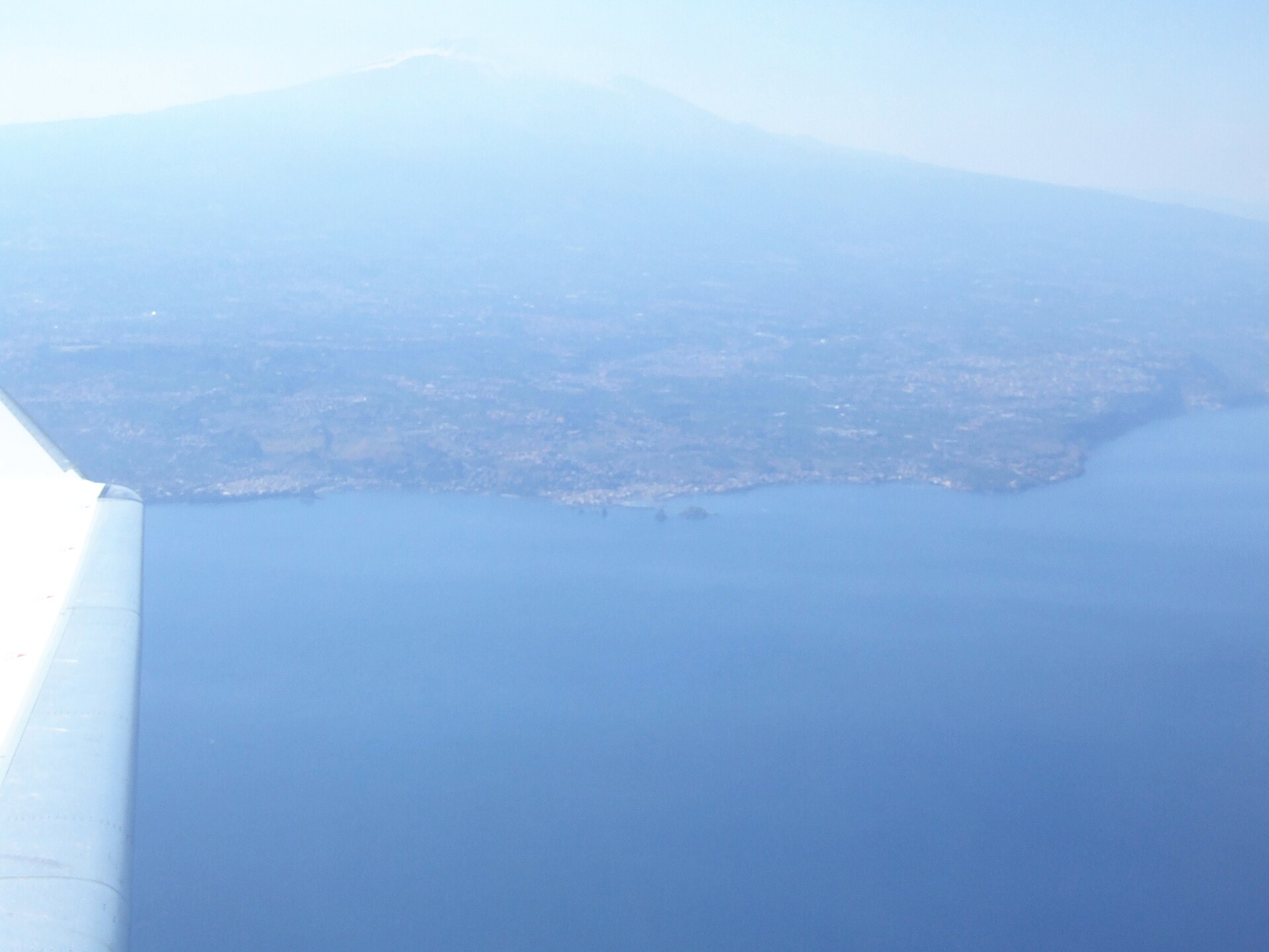
Aci Trezza is only a few kilometres away but socially distinct: a fishing harbour, a dense promenade and dark volcanic stacks offshore. The place is connected both to the Cyclops episode in Homer and to Giovanni Verga's novel I Malavoglia. Neither cultural story should replace the geology; the stacks are volcanic formations. Come for a short boat outing, a swim from a suitable platform or an evening around the harbour, not for a wide and softly shelving sandy beach.
5. Acireale's Baroque centre and La Timpa
Acireale stands above the coast. Piazza del Duomo, basilicas and Baroque façades occupy a compact centre, but the city's geography makes more sense at the edge of La Timpa nature reserve, the steep fault escarpment facing the sea. Historic paths link the upper town with small coastal settlements such as Santa Maria la Scala. A descent also requires a climb back. Avoid the hottest hours and verify local path conditions after heavy rain.
6. Giarre and Riposto as a lived-in pair
Giarre and Riposto do not offer the concentrated monument list that makes Taormina easy to market. They reveal something less common: an ordinary eastern Sicilian urban area set between citrus land, railway, port and volcano. Visit a market, walk Riposto's harbour edge and eat somewhere that does not depend entirely on day visitors. The value of these towns is not that they are secret masterpieces. They work as local centres and as a practical base for several landscapes.
7. Taormina's ancient theatre
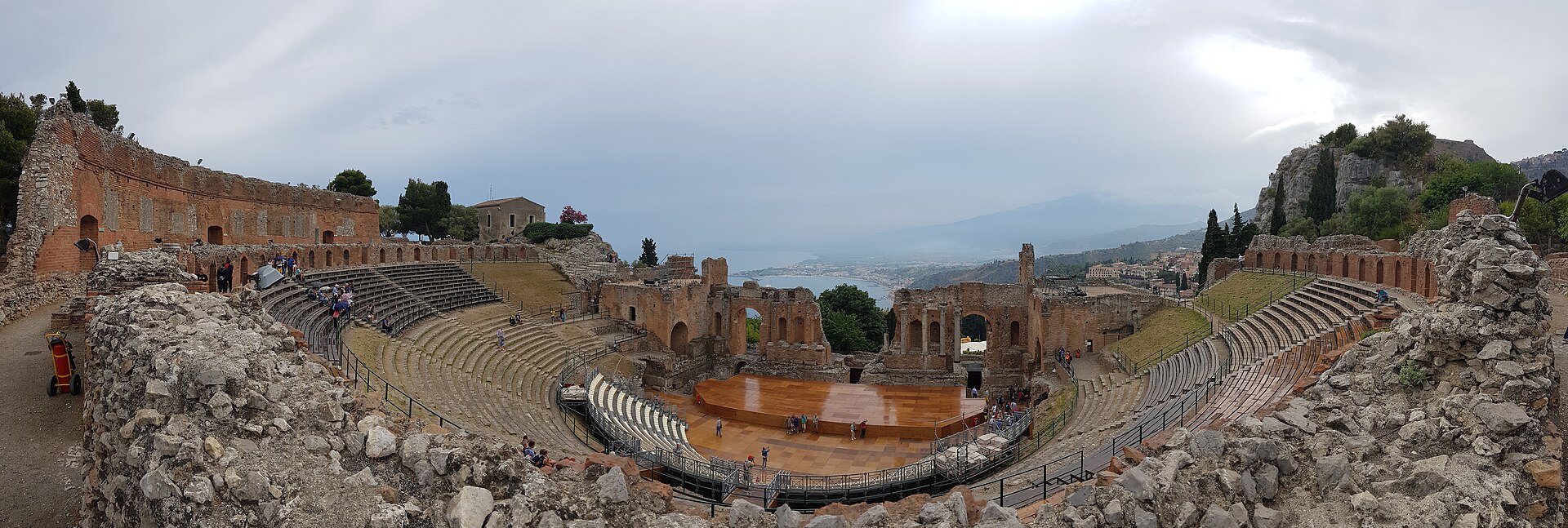
Taormina is popular for legitimate reasons, but timing shapes the experience. The ancient theatre combines Greek origins, Roman alterations and a setting in which Etna and the coast become part of the stage. Enter close to opening before large groups fill the cavea. Continue through Corso Umberto, deciding consciously how much time to give views, shops and monuments. Our honest Taormina guide separates enduring value from the premium attached to a famous address.
8. Giardini Naxos and Sicily's first Greek colony
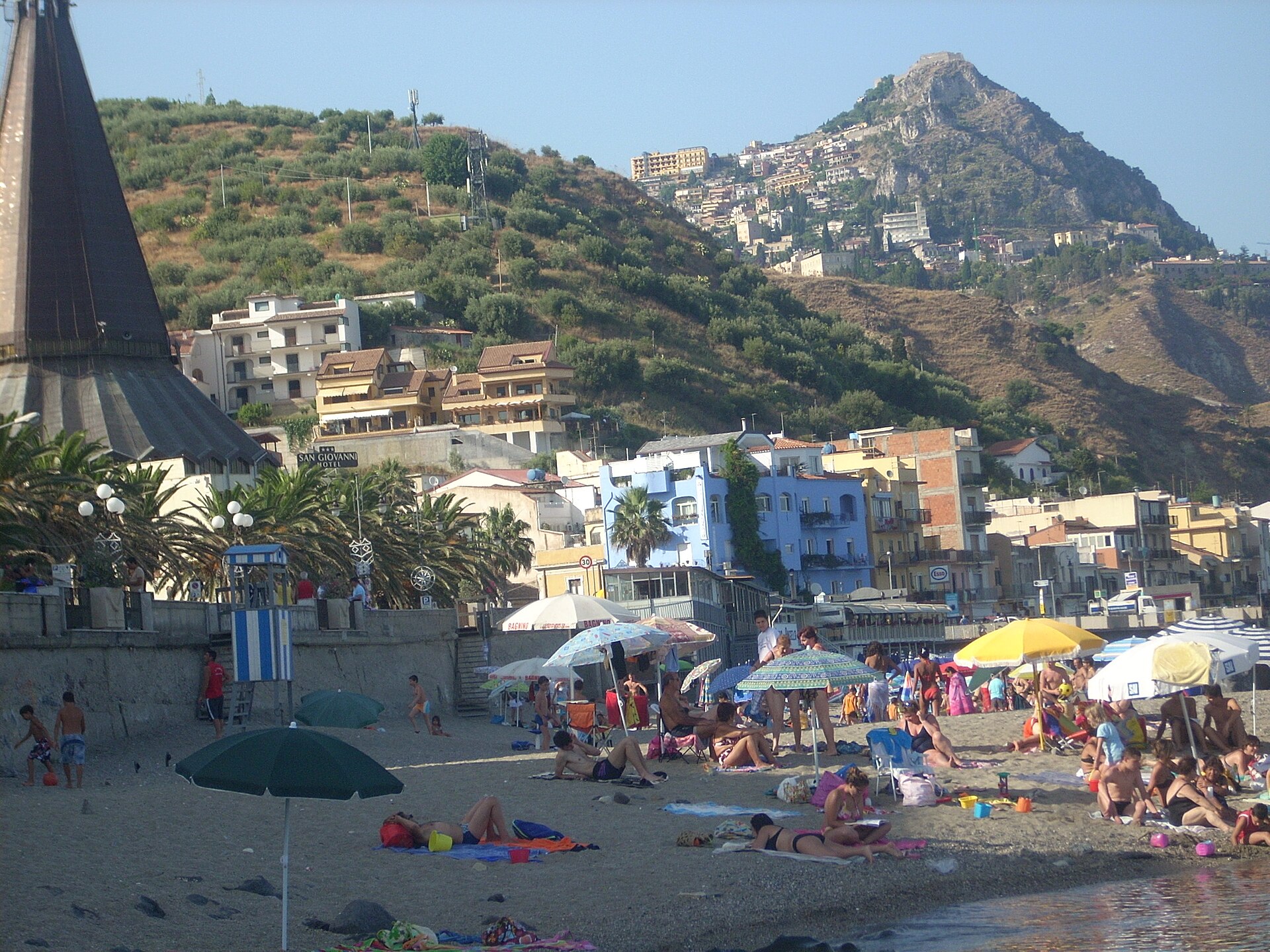
At Capo Schisò lie the remains of Naxos, identified by the Sicilian regional authorities as the island's first Greek colony. The archaeological area covers roughly 40 hectares and preserves a street plan, houses, walls and sacred areas; the museum displays material from decades of excavation. Its low remains demand more imagination than Taormina's theatre, but tell a more fundamental story about Greek settlement. Combine archaeology with the waterfront using our Giardini Naxos guide.
9. The Alcantara Gorge
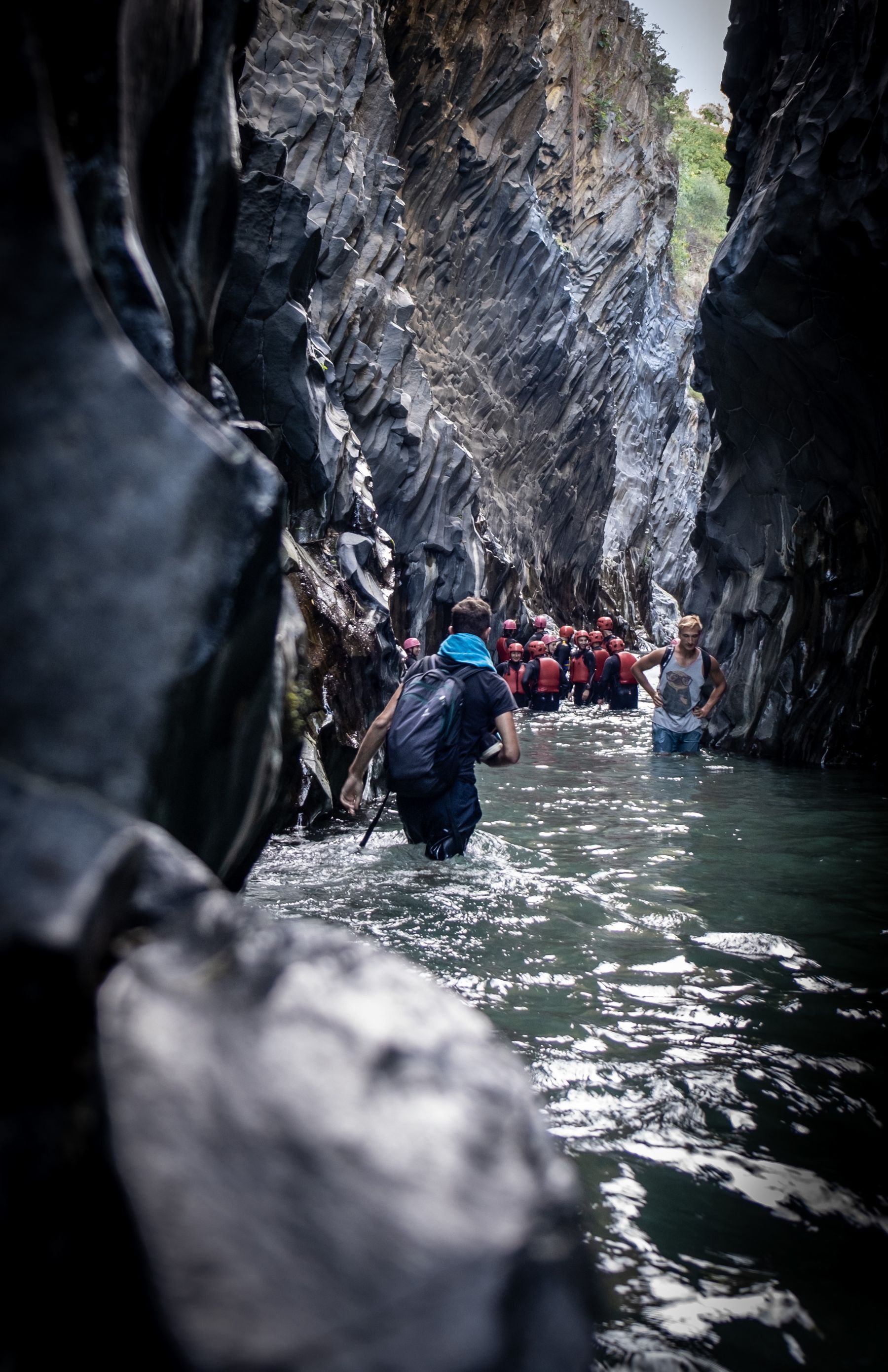
The Alcantara River cut through cooled lava flows, exposing columnar basalt arranged like organ pipes, fans and stacked timber. The principal Larderia gorge is about 400 metres long, only a few metres wide in places and bounded by walls reaching roughly 50 metres, according to the official river park. River level can be reached by a municipal staircase or through a private facility, but access varies with weather and water. Read our complete Alcantara Gorge guide before choosing footwear or an activity.
10. Castiglione di Sicilia and the upper Alcantara Valley
Castiglione occupies high ground between Etna and the Peloritani. Its lanes, churches and castle remains are a calm counterpoint to the busiest gorge entrance. The surrounding territory is also important to Etna DOC wine. Book producer visits and keep the driver alcohol-free. Combine the town with Francavilla di Sicilia or a short route published by the river park rather than racing between multiple tastings.
11. Etna from the south
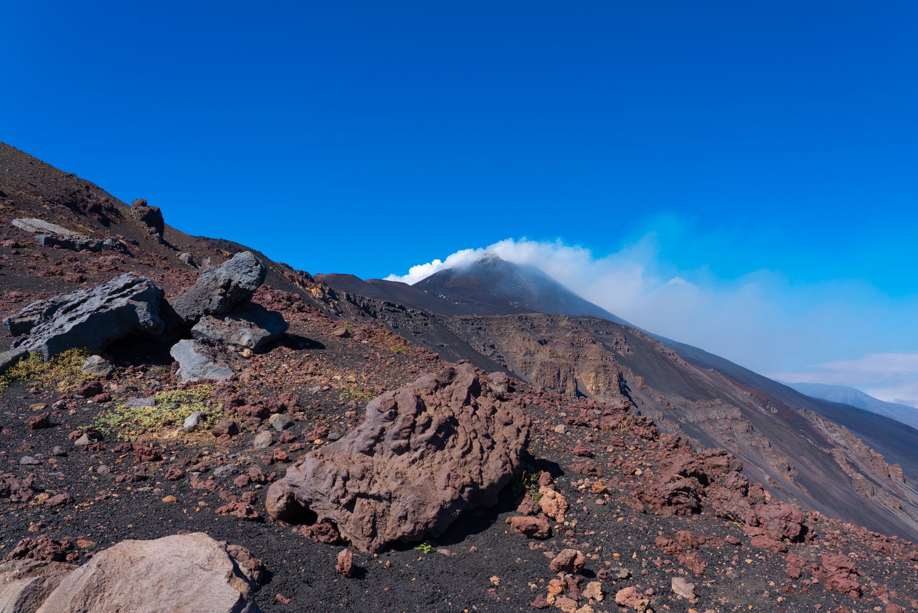
Rifugio Sapienza is the most developed high-altitude access point on Etna's southern side. Lower Silvestri craters are nearby and, when operations and safety rules permit, a cable car and organised transport travel higher. Etna is not an attraction with guaranteed opening: wind, snow, ash and volcanic activity can change options that morning. UNESCO's property covers 19,237 uninhabited hectares of the strictly protected high mountain. Use our independent Etna guide and check current official notices.
12. Etna from the north: Piano Provenzana and Linguaglossa
The north is not simply a quieter duplicate of the south. Forest, recent lava and views towards the Nebrodi create a different landscape, while Linguaglossa supplies services below. Piano Provenzana was heavily affected by the 2002 eruption, a reminder that tourism infrastructure on an active volcano is provisional. Choose this side when it suits the weather and your route; do not drive around the mountain only to claim both access points.
13. Zafferana Etnea, Milo and the inhabited slopes
Etna also exists below the excursion zone. Zafferana Etnea and Milo sit among chestnut trees, orchards and vineyards where the volcano is a working landscape. They reveal the relationship between lava-derived soils, altitude and local production without requiring a summit ambition. Visit an information point, a producer with an arranged tour or a village event if the timing works. Fields and narrow agricultural roads remain workplaces, not public viewing platforms.
14. Ortygia in Syracuse
Ortygia is Syracuse's historic core and one of the Mediterranean's clearest examples of sacred reuse. Columns from the fifth-century BCE Temple of Athena remain embedded in the cathedral; Christian and Baroque layers literally occupy the Greek structure. Walk from the Temple of Apollo through the market streets to Piazza Duomo and the Fountain of Arethusa. Arrive early to see a resident neighbourhood before day visitors and the evening audience converge on the same narrow streets.
15. Neapolis in Syracuse
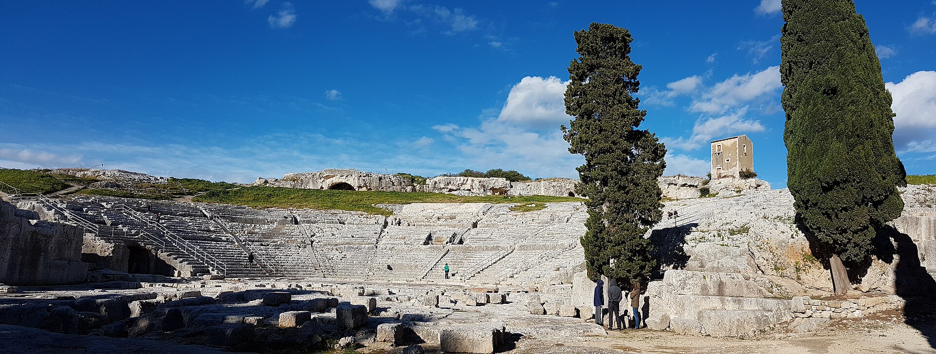
The Neapolis archaeological zone stands on the mainland and should not be reduced to an appendix after Ortygia. Its Greek theatre, ancient quarries, the cave known as the Ear of Dionysius and Roman amphitheatre reveal changes in the city's political and performative life. Shade is limited and surfaces uneven, making morning the sensible choice. Theatre performances can alter access patterns; consult the regional archaeological park before travelling.
16. The rock necropolis of Pantalica
Pantalica is not a conventional urban sight but a large rock landscape between Sortino and Ferla. UNESCO records more than 5,000 rock-cut tombs, mainly from the thirteenth to seventh centuries BCE, alongside later Byzantine traces. Routes require sound footwear, water, navigation and respect for heat and fire risk. Select one entrance and a manageable walk rather than attempting a full traverse without preparation. Check road and trail conditions locally after rain.
17. Corso Vittorio Emanuele in Noto
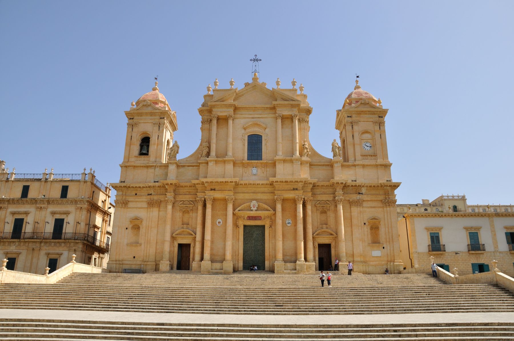
Noto was rebuilt on a new site after the 1693 earthquake. Its central axis, including Porta Reale, the cathedral, Palazzo Ducezio and several churches, demonstrates planned Baroque composition in local limestone. Walk the street in both directions because light changes the relationship between steps and façades. Noto fits into half a day, but improves when you leave the main axis to see housing, side staircases and the practical city behind the monumental frontage.
18. Vendicari reserve
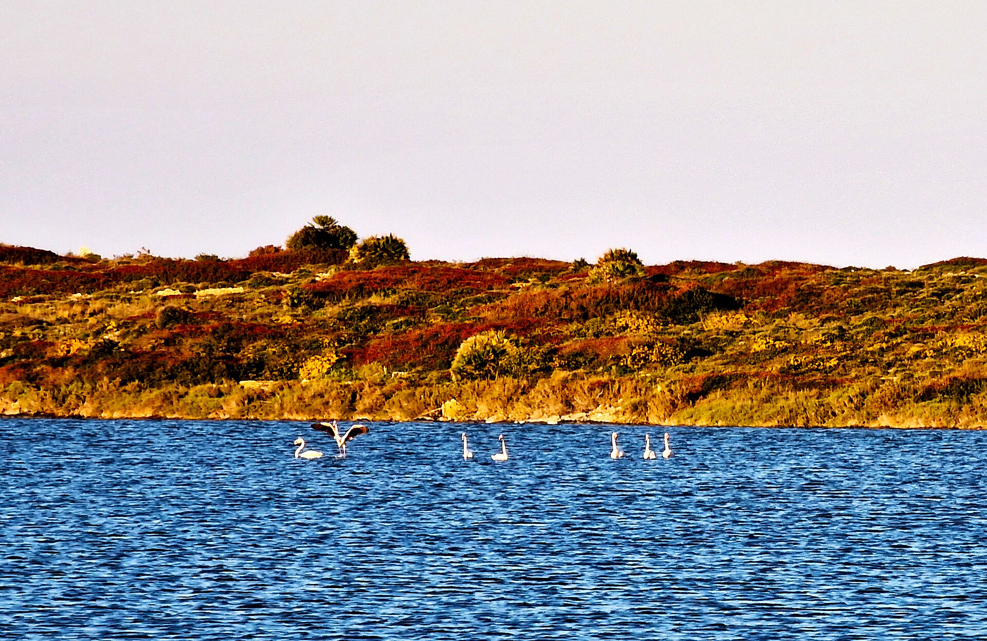
Between Noto and Pachino, Vendicari protects lagoons, sandy and rocky shores, and stopping places for migrating birds. The paths are not technically demanding, but shade is scarce and services on the routes are minimal or absent. Carry water, a hat and food, and remove every item of waste. Choose the entrance according to your purpose: bird habitats and the old tuna-processing landscape, a longer coastal walk or a beach day. This is a reserve, not a serviced lido.
19. Modica's two levels
Modica occupies a deep valley and the slopes above it, rewarding visitors who accept stairs and vertical movement. The Cathedral of San Giorgio dominates the upper town while the lower town follows the valley. Chocolate is a genuine local tradition but should not reduce Modica to tastings; architecture, flood history and topography explain its structure. Park once and walk, or investigate local transport between levels if mobility is limited.
20. Ragusa Ibla
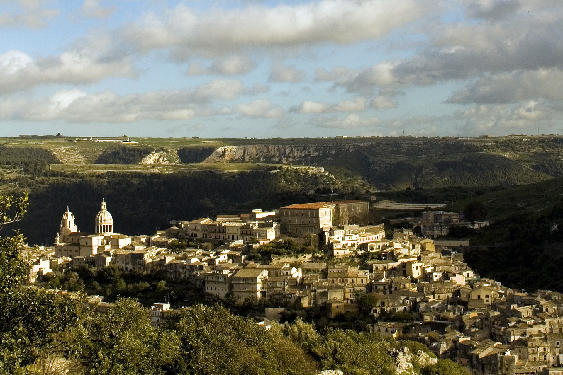
After the earthquake, Ragusa developed both the older Ibla and the higher, planned Ragusa Superiore. Views between them make the rupture visible. In Ibla the streets lead towards the Cathedral of San Giorgio and Giardino Ibleo, but the most revealing spaces are often the transitions where homes, churches and staircases adapt to rock. The city is too far from Giarre for a relaxed routine outing; stay in the south-east or accept a very long day.
Building a route that works
| Geographical cluster | Realistic time | Useful combination | Main constraint |
|---|---|---|---|
| Catania | 1 full day | Duomo, Pescheria, Via Crociferi, monastery | Heat, traffic and variable opening |
| Aci coast | Half to full day | Aci Castello, Aci Trezza, Acireale | Parking and rocky water access |
| Taormina and Naxos | 1 full day | Theatre early, Naxos later | Peak-season congestion |
| Etna | 1 full day | One mountain side and one town | Weather and volcanic restrictions |
| Syracuse | 1 full day | Neapolis morning, Ortygia later | Too much for a short afternoon |
| Baroque south-east | 2–3 days | Noto, Modica, Ragusa, Vendicari | Distance and summer heat |
Drivers should park at the edge of historic centres. Camera-controlled ZTL areas operate in several towns, and navigation software does not reliably distinguish a legal visitor route from resident-only access. Read our Sicily car-rental guide. Rail is useful along the east coast, particularly between Catania, Acireale, Giarre-Riposto and Taormina-Giardini, but station locations and schedules require checking with the operator. Etna, Pantalica and many rural stops need a car, organised bus excursion or guide.
Season changes the order. From June through September, archaeological sites and city walks belong in the morning, leaving beaches and a long lunch for the hottest hours. Spring and autumn suit stairways, gorges and Baroque towns, but rain can alter rivers, trails and country roads. In winter, coastal cities remain lived in while visitor services may reduce hours. Check our month-by-month Sicily weather guide before locking every day into a fixed programme.
The less visible eastern Sicily
Tourism produces a sharp geographical imbalance. Taormina, Ortygia and Noto concentrate visitors, short lets and high prices inside small historic centres. Only a few kilometres away, lived-in towns face outward migration, slow public transport and the cost of maintaining an enormous heritage stock. Travellers do not solve this by hunting for a supposedly undiscovered village. They can use local businesses, follow access rules, avoid blocking residential streets and divide time between icons and ordinary centres.
A morning in Giarre, a walk in Francavilla or lunch in Linguaglossa is not meaningful because nobody else knows it. It matters because it reconnects monuments with the communities that sustain the region. Etna becomes clearer when vineyards, repaired roads and ash deposits are visible in its towns. Naxos becomes more than a beach when you walk its ancient street plan.
Official sources and last-minute checks
Historical and site information was checked against Visit Sicily, UNESCO on Etna, UNESCO on the Val di Noto, UNESCO on Syracuse and Pantalica, the Naxos and Taormina Archaeological Park and the Alcantara River Park. Hours, prices, roads, volcanic conditions, fire alerts and natural-site access change. Confirm them on official pages shortly before departure.
Conclusion: choose connections, not the maximum number of stops
Eastern Sicily's power is not merely that coast, volcano, ancient city and Baroque architecture stand relatively close. The revealing part is how each altered the others: lava became building material, earthquakes became urban plans, ports became colonies and mountain villages became a modern wine landscape. Select six or seven places that explain those relationships and leave the rest for another visit. Space in the schedule lets you respond to Etna, weather, opening times and local pace. That is not seeing less. It is giving the places enough time to make sense.